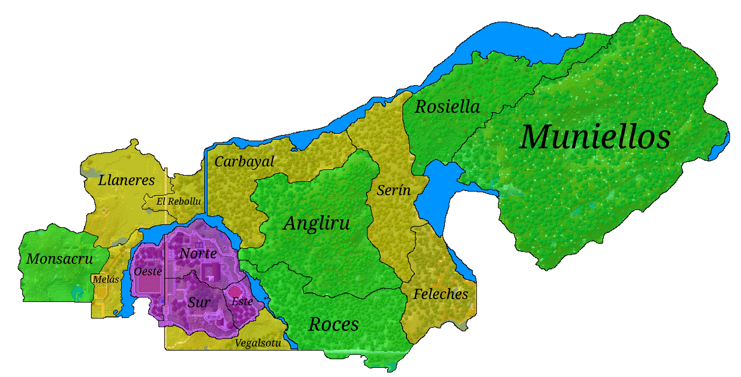
File:District Map of Anneimd.png
Size of this preview: 800 × 407 pixels. Other resolution: 2,500 × 1,271 pixels.
Original file (2,500 × 1,271 pixels, file size: 845 KB, MIME type: image/png)
A map of Anneimd showing Districts and a background of the natural surface colors.
File history
Click on a date/time to view the file as it appeared at that time.
| Date/Time | Thumbnail | Dimensions | User | Comment | |
|---|---|---|---|---|---|
| current | 21:42, 6 February 2025 | | 2,500 × 1,271 (845 KB) | Carboo (talk | contribs) | |
| 20:26, 1 February 2025 | 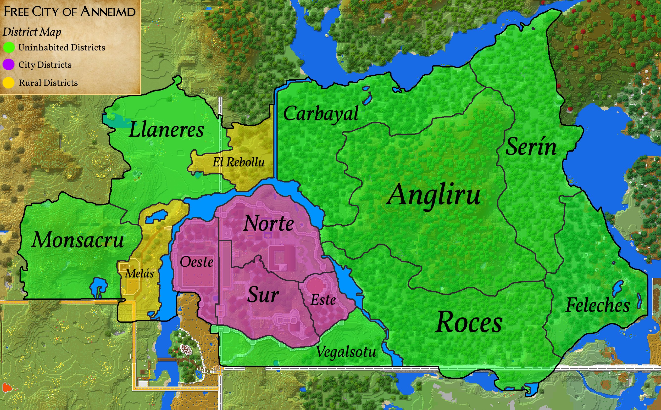 | 2,676 × 1,658 (1.45 MB) | Carboo (talk | contribs) |
You cannot overwrite this file.
File usage
The following page uses this file: