File:TSAGAAN as of 29-1-2025.png

Size of this preview: 778 × 600 pixels. Other resolution: 1,478 × 1,139 pixels.
Original file (1,478 × 1,139 pixels, file size: 418 KB, MIME type: image/png)
Summary
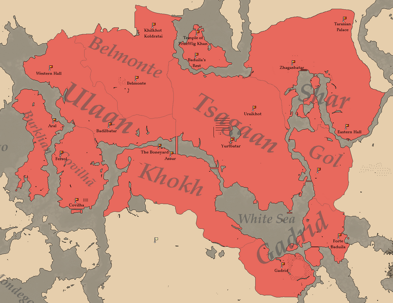
Map of the Tsagaan Khanate as of January 29th, 2025. Showcasing its settlements, regions and borders.
File history
Click on a date/time to view the file as it appeared at that time.
| Date/Time | Thumbnail | Dimensions | User | Comment | |
|---|---|---|---|---|---|
| current | 15:47, 9 February 2025 | | 1,478 × 1,139 (418 KB) | Vitammortem (talk | contribs) | Map of the Tsagaan Khanate as of January 29th, 2025. Showcasing its settlements, regions and borders. |
You cannot overwrite this file.
File usage
The following page uses this file: